
Longview Neighbors by Block
No public source found for Longview supplies a complete, current list of all neighbors. The useful approach is source by source. Start with the geometry around one address, keep each parcel ID, then test that parcel in the current appraisal and County Clerk systems. The result distinguishes location, recorded party, and community context instead of turning a map into a profile of people.
| Source | What It Shows About a Block | Access |
|---|---|---|
| Longview ArcGIS parcel layer | Adjacent geometry, parcel ID, situs, lot, block, and source fields | Public map service; published parcel source dates are old |
| Gregg Appraisal District | Appraisal account, owner lead, situs and mailing fields, subdivision | Public GCAD search, with appraisal disclaimer |
| Gregg County Clerk | Recorded parties, dates, instruments, and legal descriptions | Official Clerk route, counter available |
| City addressing and limits | Street numbering, city or ETJ context, and related geography | City map and addressing resources |
| HOA certificate search | Association or management-certificate entry, when filed | State search with a completeness disclaimer |
Owner and occupant are different roles. A deed or appraisal result may identify a recorded or listed owner, while a household can change without a new deed. A directory, voter route, or association record has its own purpose and access limits. Use each source only for the question it was designed to answer.
Longview Neighbor Parcel Layer
The Longview NonUtilities parcel layer merges City of Longview parcels and GCAD parcels outside the ETJ, with some City of Kilgore and Gregg CAD coverage. Its published fields include parcel and property IDs, county, name, address lines, ZIP, legal description, lot, block, subdivision, instrument references, deed date, values, acreage, building information, and geometry. It is a rich geographic lead, not a resident roll.
The parcel-layer record shows the searchable attributes that help place a Longview neighbor question on the right lot.
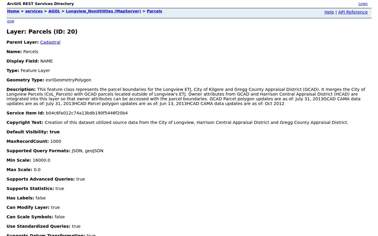
Keep the parcel ID, legal description, and source date together. They make the next GCAD or Clerk lookup more reliable than a copied owner label.
Longview Neighbor Map Dates
Myth: map detail means current ownership. The service reports GCAD parcel polygons and CAMA data dated July 31, 2013, HCAD polygons dated June 13, 2013, and HCAD CAMA dated October 2012. A parcel layer can therefore show deed-like fields while still being stale. Use it to find geometry and a parcel identifier, then move to current GCAD information and the County Clerk's recorded instrument route.
GIS adjacency is not proof of shared ownership, shared access, a boundary agreement, or any personal relationship. A survey, recorded plat, or current custodian record is needed for questions that go beyond spatial context. The City also notes that an address correction does not automatically update USPS, utilities, GCAD, banks, insurance providers, or navigation systems.
Note: A Longview parcel map is a geography tool, so date every map result before using it as a lead for a current-record search.
Map a Longview Neighbor Block
Keep the work to the immediate parcels touching or facing the starting lot. This process follows the documented address-to-record method without turning a whole named street into one search. For a full street-by-street record chain, use the Longview by-street directory after the block question is settled.
- Normalize the starting address, including number, direction, suffix, unit, ZIP, and any older street name. Check City 9-1-1 addressing when a number seems out of sequence.
- Locate that address in the parcel layer and visually identify only the adjacent parcels. Capture the parcel ID, situs, legal description, and the layer's source date.
- Search each ID or address separately in GCAD. Compare the appraisal account, owner lead, mailing field, and subdivision rather than assuming the map label is current.
- Confirm a conveyance, lien, release, easement, plat, or deed of trust in the County Clerk index or image. Preserve the instrument number and prior instrument reference.
- Stop when the records show a protected address, a sensitive detail, or a conflict that needs the custodian rather than more correlation.
This flow is deliberately narrow. A map can identify adjacent lots, while the deed and appraisal paths identify different forms of property information. Neither makes a claim about private household membership.
Longview Neighbors and Owners
GCAD accepts Owner Name, Street Number, Street Name, Property ID, Geographic ID, Subdivision, Neighborhood, Tax Year, and other controls. When an exact address fails, GCAD recommends a simple street-name or partial-name search before narrowing through Advanced Search. Its legal descriptions and acreage are supplied for appraisal purposes, so verify material legal-boundary questions with the Clerk record or a survey.
The County Clerk is the recorded-instrument custodian. Search both grantor and grantee where a name changes through an estate, trust, marriage, corporation, or correction. Mark whether the entry is a deed, deed of trust, release, assignment, easement, plat, lien, or correction. If a historic book or image is unavailable online, the Clerk counter, phone route, and Texas State Library Gregg guide are documented alternatives.
GCAD currently warns that a software conversion may make acreage on some notices incorrect and that certified totals were not yet available at review. Preserve the parcel ID and ask GCAD to confirm a critical specification.
Longview Neighborhood Certificate Context
The Texas HOA management-certificate search can provide association or management context, not a roster. Research located Longview and Gregg entries including Virginia Woods, Wildwood, Grace Acres Phase 1, Hollybrook Coves, Mallard Cove, and Timber Falls. That is useful when a parcel's subdivision label needs an association lead, but it does not prove membership, occupancy, or a current management relationship.
| Community layer | What the research supports |
|---|---|
| Texas HOA certificate database | Management-certificate entries may identify an association or management contact, subject to the database warning. |
| Published association pages | Hunters Creek Longview, Longview Mill Run, Townlake Homeowners, and Forest Oaks may publish meeting or contact context. |
| City volunteer channels | Neighborhood Watch, Citizens on Patrol, and Project 365 provide civic context without private rosters. |
The state database expressly says entries are user-supplied and that completeness, reliability, and validity are not guaranteed. Check the county and ZIP filters, since a Longview mailing address can appear in another county. Keep private association material separate from public-government records.
Longview Civic Neighbor Context
Longview volunteer opportunities identify Neighborhood Watch, Citizens on Patrol, Project 365, and related civic routes. They can help a person learn how community participation works without trying to assemble a list of private members. For a property concern, Development Services, Code Compliance, and the city records channel have separate responsibilities and record rules.
A permit, inspection, or code file is place-based. It may contain names or signatures, but it is not a neighborhood roster. Request a defined address, permit number, complaint date, or case number through the appropriate city channel, recognizing that redactions can apply.
Note: Community involvement is different from parcel ownership, and neither one is proof that a person currently lives at a nearby address.
Longview Neighborhood Geography Changes
Longview neighborhood labels are not interchangeable. A place can be a subdivision, historic area, postal place, HOA, census geography, or informal local name. The historic survey offers useful context for Greggton, Pine Tree, Spring Hill, Northcutt Heights, and Green Acres. Greggton began as Willow Springs and entered a large 1959 annexation. Northcutt Heights was platted around 1910, while Green Acres was platted west of Judson Road in 1938.
Those dates explain why an older directory, mailing city, or jurisdiction can differ from a current parcel label even when a structure did not move. Compare a plat or deed, city-limit or ETJ layer, parcel GIS, permit history, directory, and civic source. A neighborhood label can outlast an annexation.
The Longview WebMap services list layers for parcels, addresses, ZIPs, city limits, districts, and nearby features.
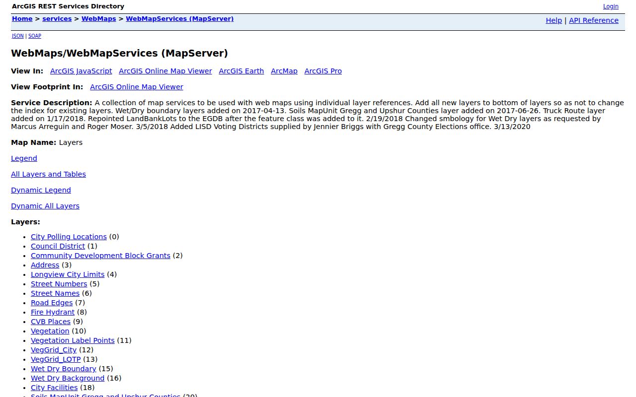
Use the map services to compare geographic layers, then return to the official custodian for any current parcel, title, or address question.
Longview Neighbor Source Comparison
Official records and commercial neighbor tools serve different purposes. A commercial category can merge stale, mismatched, or unexplained data. Official sources are narrower, but their custodian, field purpose, date, and access rule are visible. For a block question, narrow and accountable records are more useful than a broad list with no clear source trail.
| Official record path | Commercial neighbor-tool category | Practical difference |
|---|---|---|
| GIS, GCAD, Clerk, and city maps | Compiled neighbor results | Official paths identify the source and record purpose; compiled results may not. |
| Parcel or instrument dated by custodian | Undated merged profile | A source date can be checked against current records and access limits. |
| HOA certificate or civic route | Claimed community affiliation | Certificate entries and public programs do not establish private membership. |
Longview Neighbor Lookup Limits
Texas public access does not permit a person to connect or republish every field that can be found separately. The Texas Address Confidentiality Program can provide a substitute mailing address for qualifying participants. Voter confidentiality protects certain residence addresses and identifiers. Do not try to overcome a protected-address signal by matching other sources. Remove full birth dates, signatures, identification numbers, protected addresses, minors' information, medical details, victim information, and account data from notes.
Lawful use. Use Longview neighbor records for personal, lawful community, family-history, or property-curiosity research. Never use an address, parcel, or community record to stalk, harass, intimidate, or harm anyone.
If a record conflicts or appears wrong, preserve the URL and access date, then contact the agency that created it. The custodian can explain the record's scope, source date, and correction route.